In 1905, the territory of Quebec was a recognized province of Canada and had been since 1867, the year the country’s constitution was sealed with the Confederation. In the years leading up to Confederation (from 1840 to 1867), the provinces that we now know as Ontario and Quebec were part of a British colony called the Province of Canada. The Government of the Province of Canada frequently changed, which made decision-making difficult.
Politicians in Canada West (now Ontario) and Canada East (now Quebec) agreed that the creation of a new country called Canada would solve this problem. Each one would have its own provincial government that would make decisions concerning the province, while the Government of Canada in Ottawa would make decisions on issues affecting the entire population of the new country. And so, on July 1, 1867, the Canadian ConfederationThis is a group of people or nations or tribes or provinces that form an "alliance". The agreement they make allows each member to control itself, but they agree to work together for common causes. Also known as a confederacy or sometimes a league. More took place. At that time, Canada became a country with four provinces, including New Brunswick and Nova Scotia, and by dividing the Province of Canada into two new provinces: Ontario and Quebec.
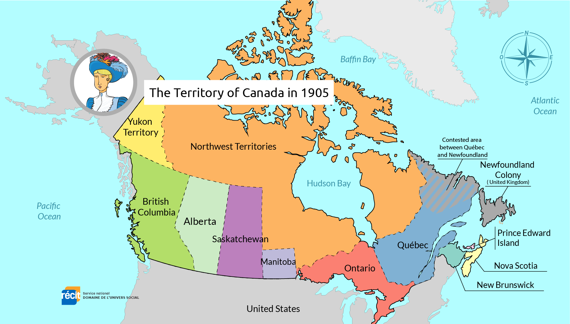
Borders
By 1905, Canada had 9 provinces and 2 territories, including the province of Quebec, which occupied the north-east of North America.
Quebec’s borders were defined as follows:
- To the north, the border stretched across the Ungava District, from James Bay to the west, and all the way to the Atlantic Ocean to the east, with a small portion of Labrador belonging to Newfoundland.
- To the south, Quebec bordered the United States.
- From the southwest to the west, the border extended along the province of Ontario.
- To the southeast, Quebec shared a border with the province of New Brunswick.
Author: Service national du Récit de l’univers social
Quickly check your knowledge: